About This Proposal
When people hear the name Tokaido, many may first think of the Shinkansen or modern railways. High-speed transportation linking eastern and western Japan still functions today as one of the nation’s main arteries.
Yet in the Edo period, there was another kind of “great artery,” different from today’s rapid transport systems. That was the Tokaido and the Nakasendo. These highways supported the movement of people and goods, while also serving as the foundation that shaped early modern Japanese society itself.
Along their routes, post towns and checkpoints were established, while castle towns, temples, merchant districts, and industrial cities developed in succession, together sustaining Japan’s economy and culture.
This proposal invites us to view these Edo-period highways and the diverse heritage spread along them as one continuous historical story.
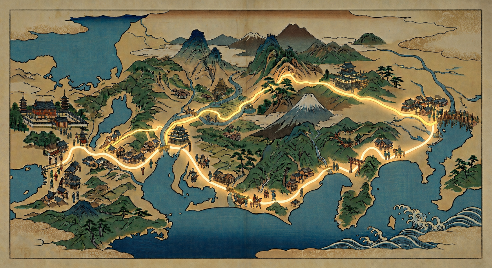
The journey begins at Nihonbashi,Tokyo
Explanation of Value
1. Highway Network
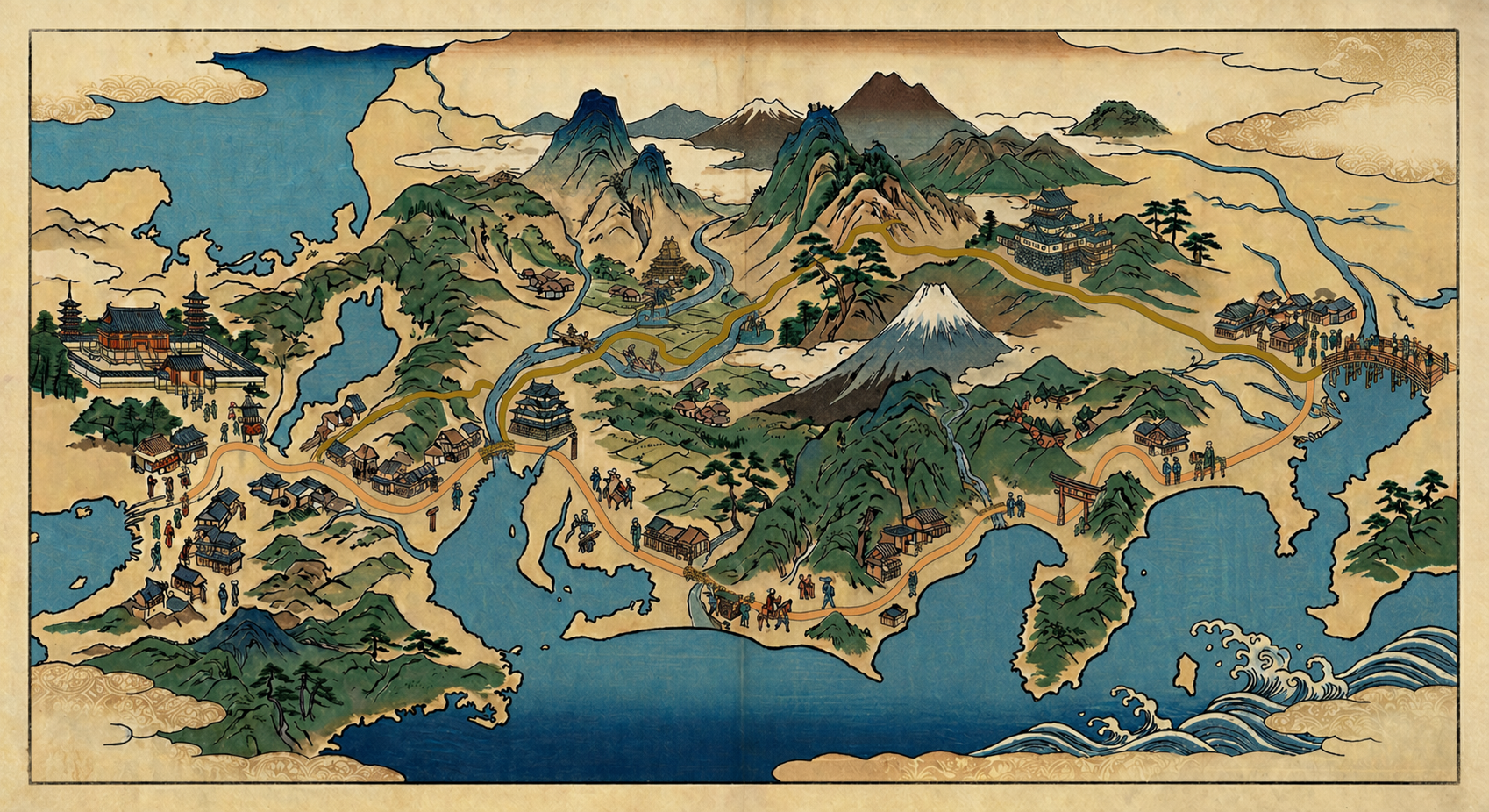
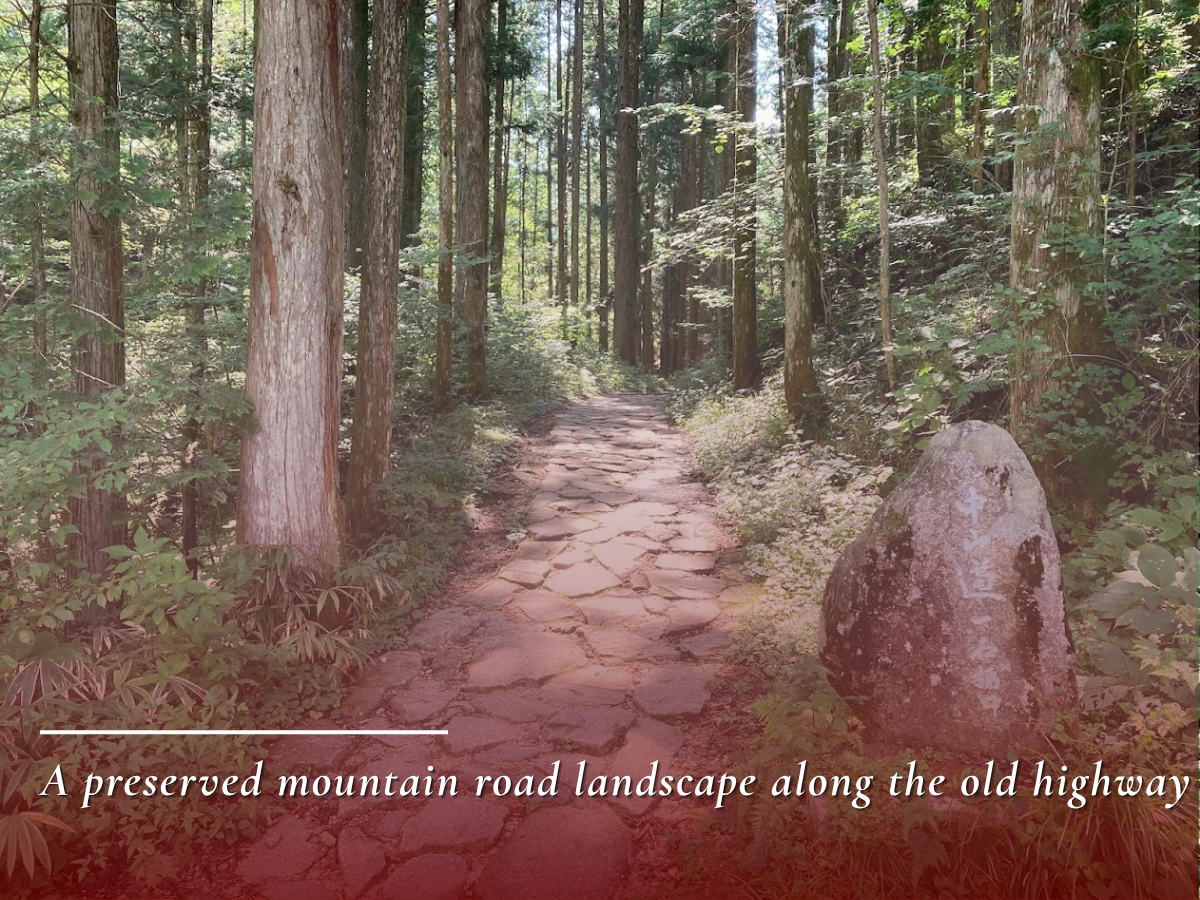
Today the journey takes only a few hours by Shinkansen, but in the Edo period, travel was mainly on foot. The Tokaido followed the coast, while the Nakasendo passed through the inland regions. People traveled these roads step by step, along routes maintained by the Tokugawa shogunate.
 Great Arteries Connecting Two Capitals
Step by step, mile by mile
→ View Details
Great Arteries Connecting Two Capitals
Step by step, mile by mile
→ View Details
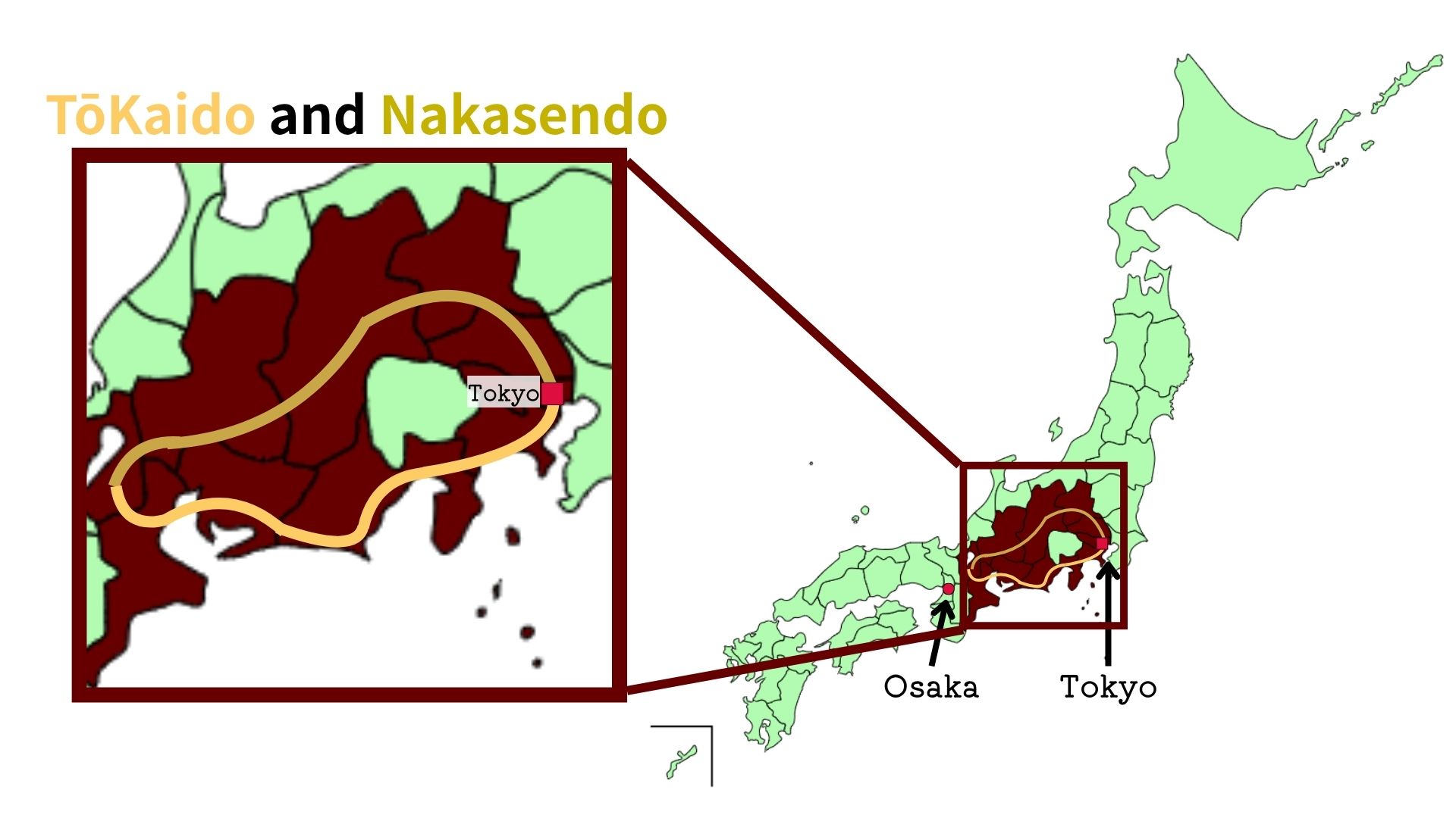
The Tokugawa shogunate developed the Tokaido and Nakasendo as major highways linking Edo, the political center, with Kyoto, the traditional imperial capital. Passing through different landscapes, the two roads functioned as principal routes supporting long-distance transportation in early modern Japan.
ClickTap the image to stop blinking
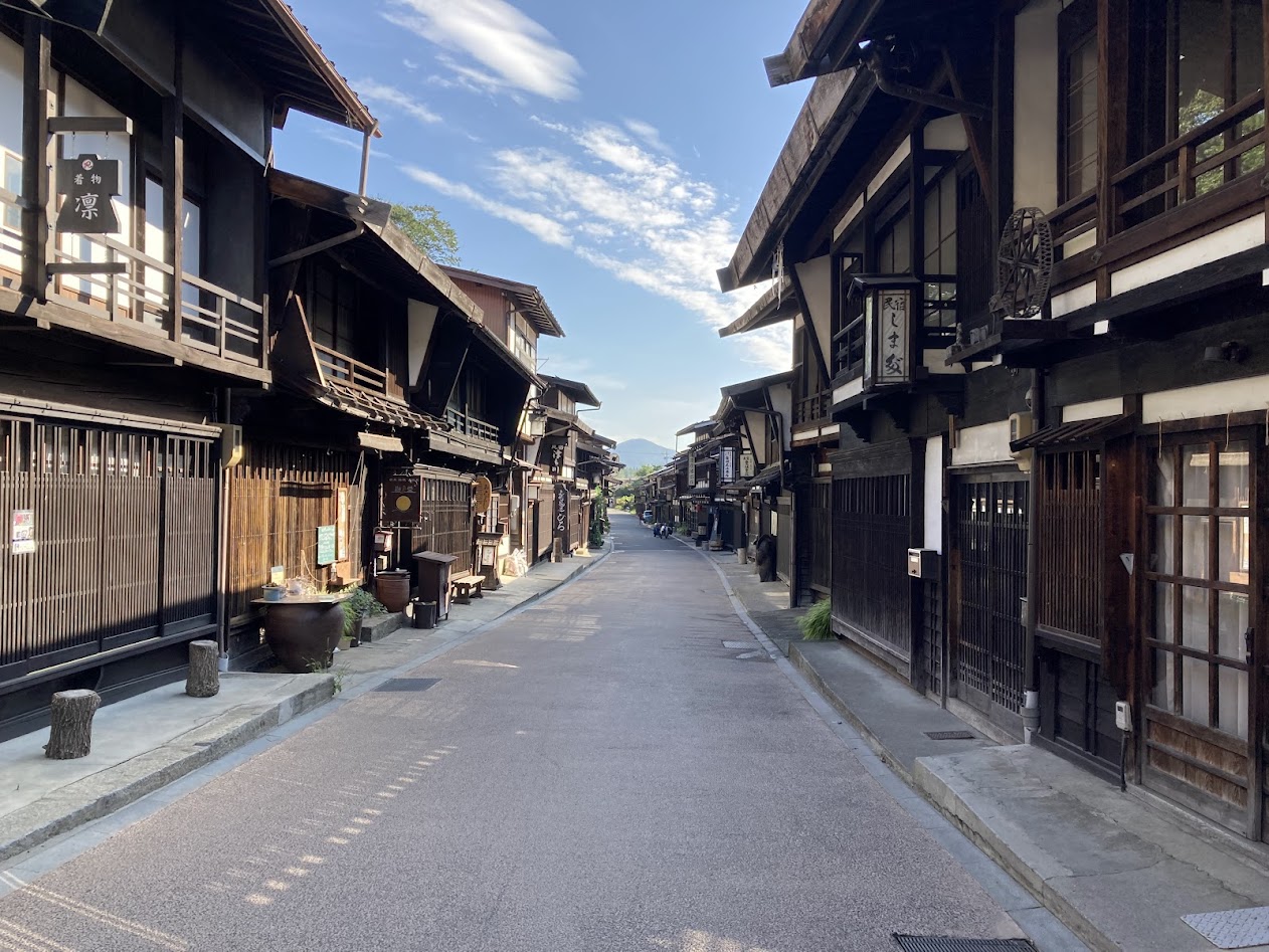
The Tokaido was the coastal route connecting Edo and Kyoto. With relatively broad plains and many castle towns and port towns along the way, it became an especially active corridor for the movement of people and goods.
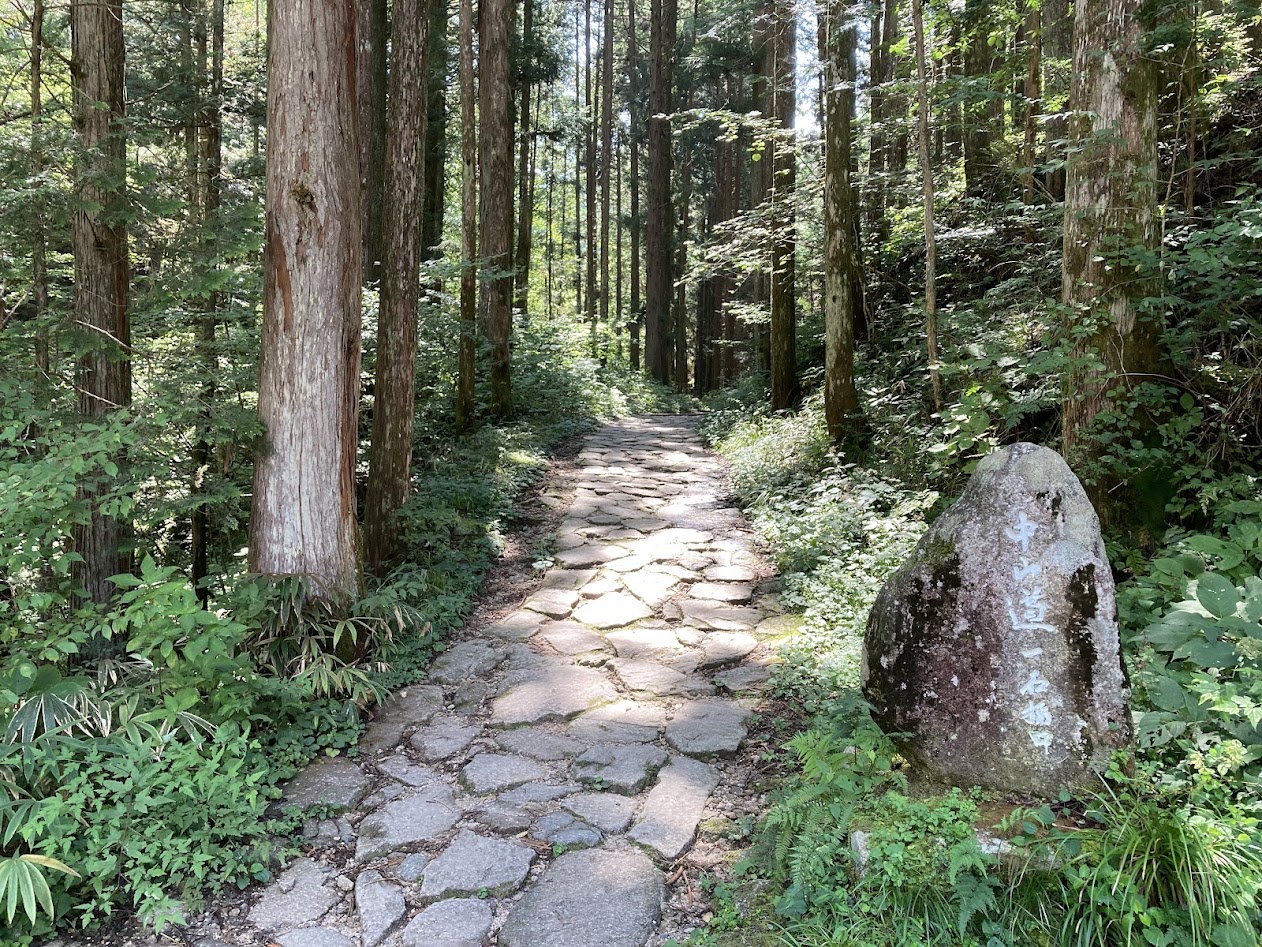
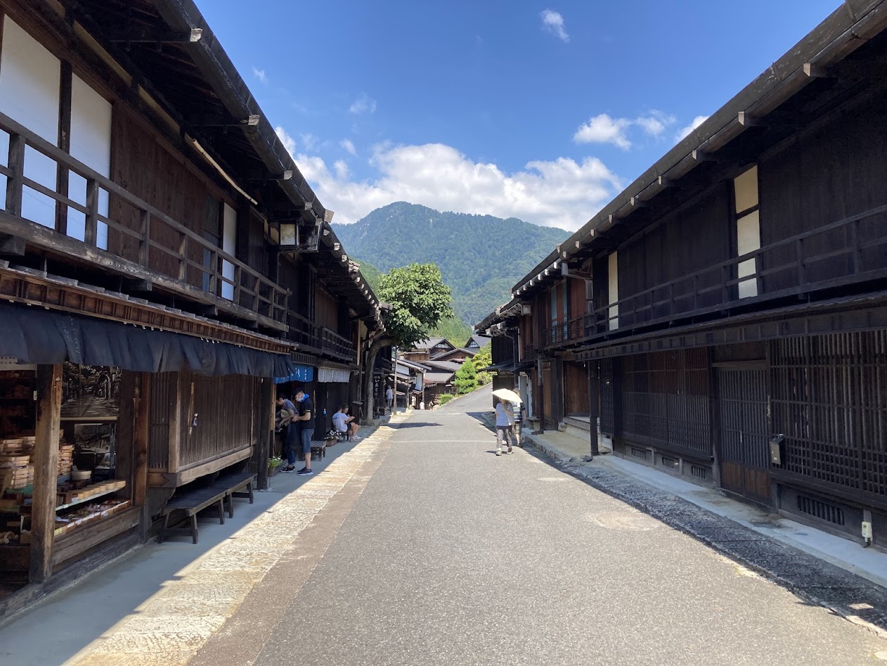
By contrast, the Nakasendo ran through inland mountain regions. Crossing passes and highland areas, it offered landscapes and travel conditions distinct from the Tokaido. Together, the two parallel highways formed a wide-ranging transportation network.
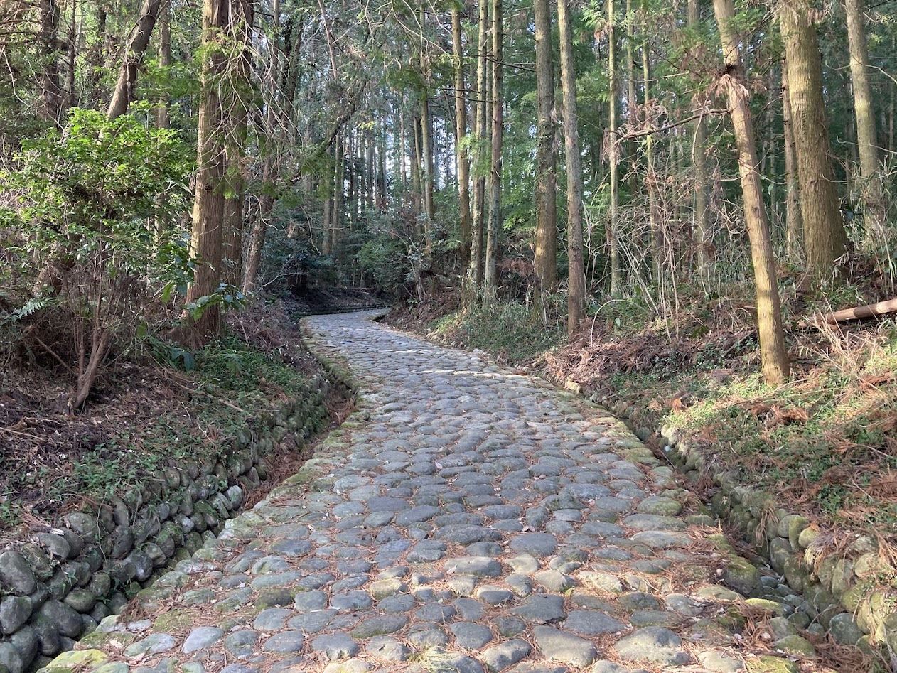
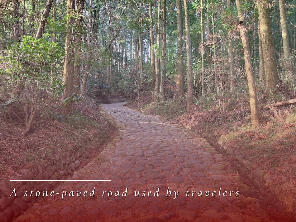
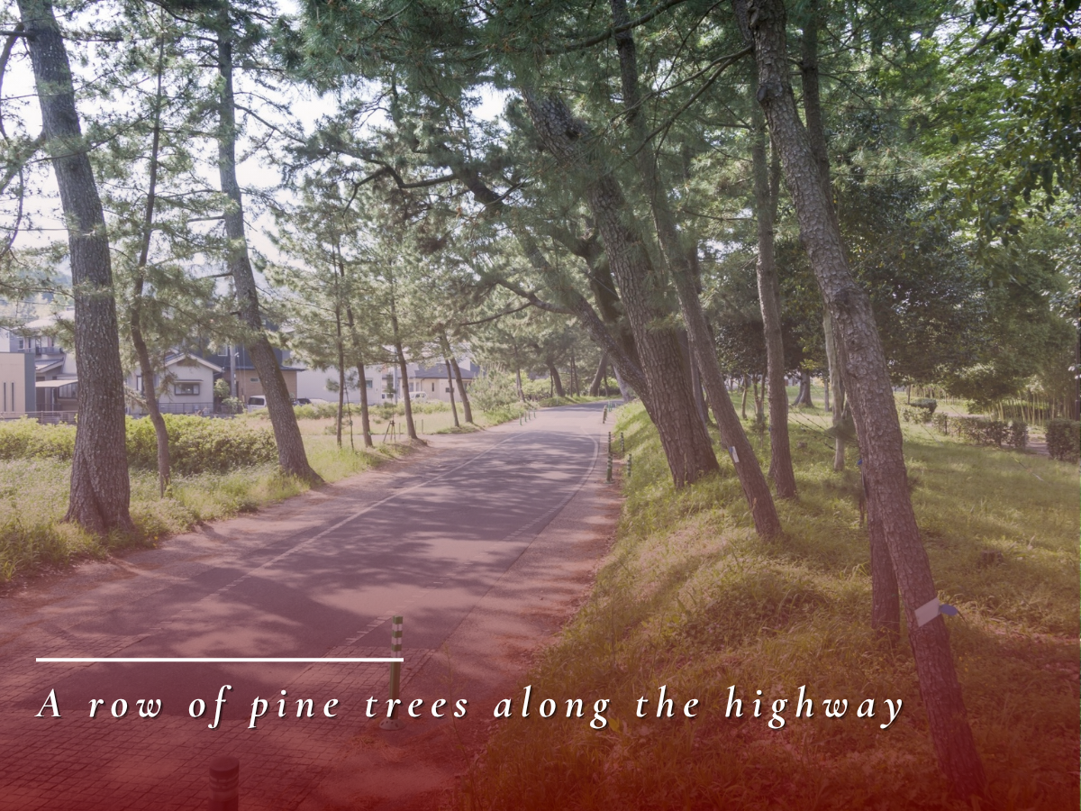
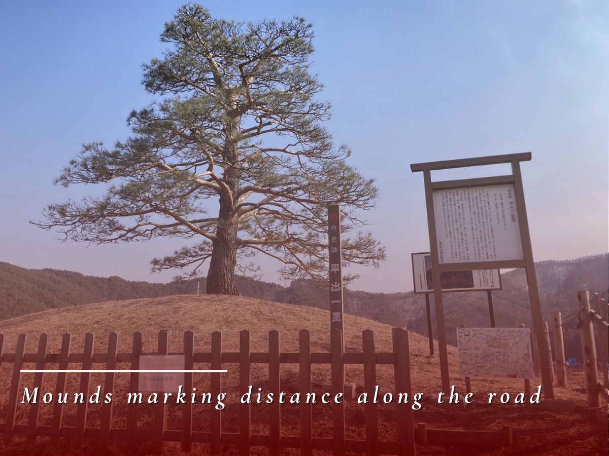
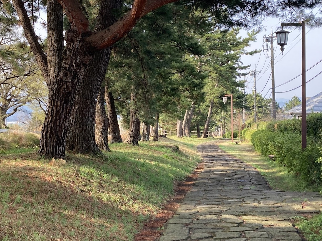
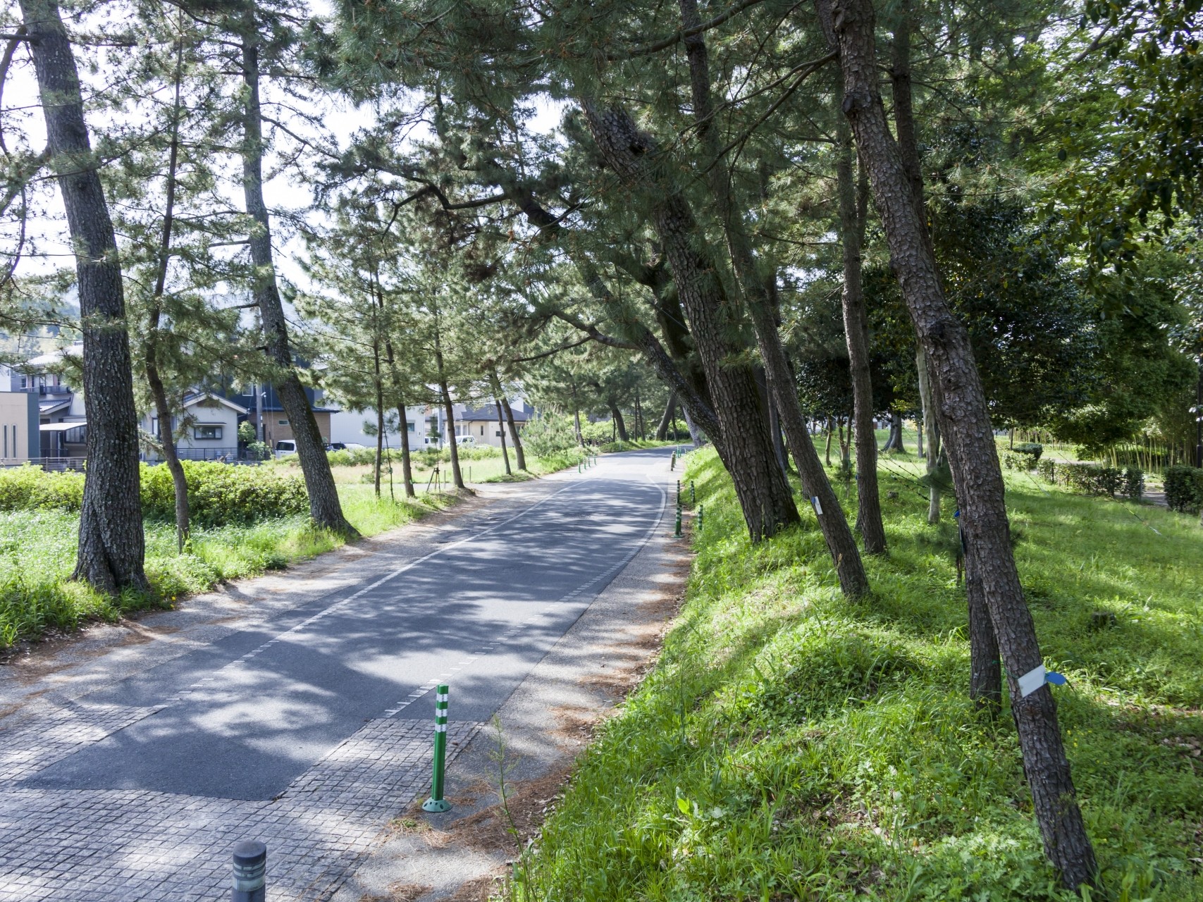
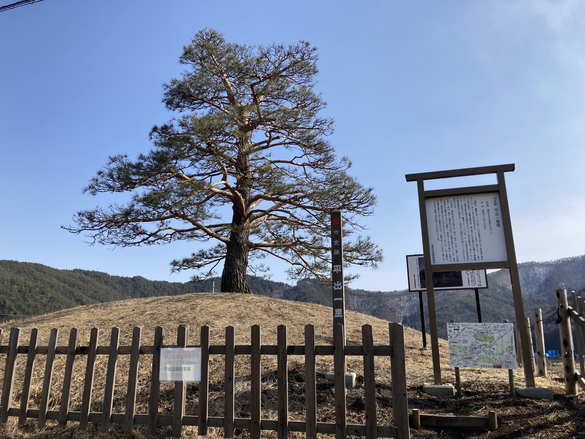
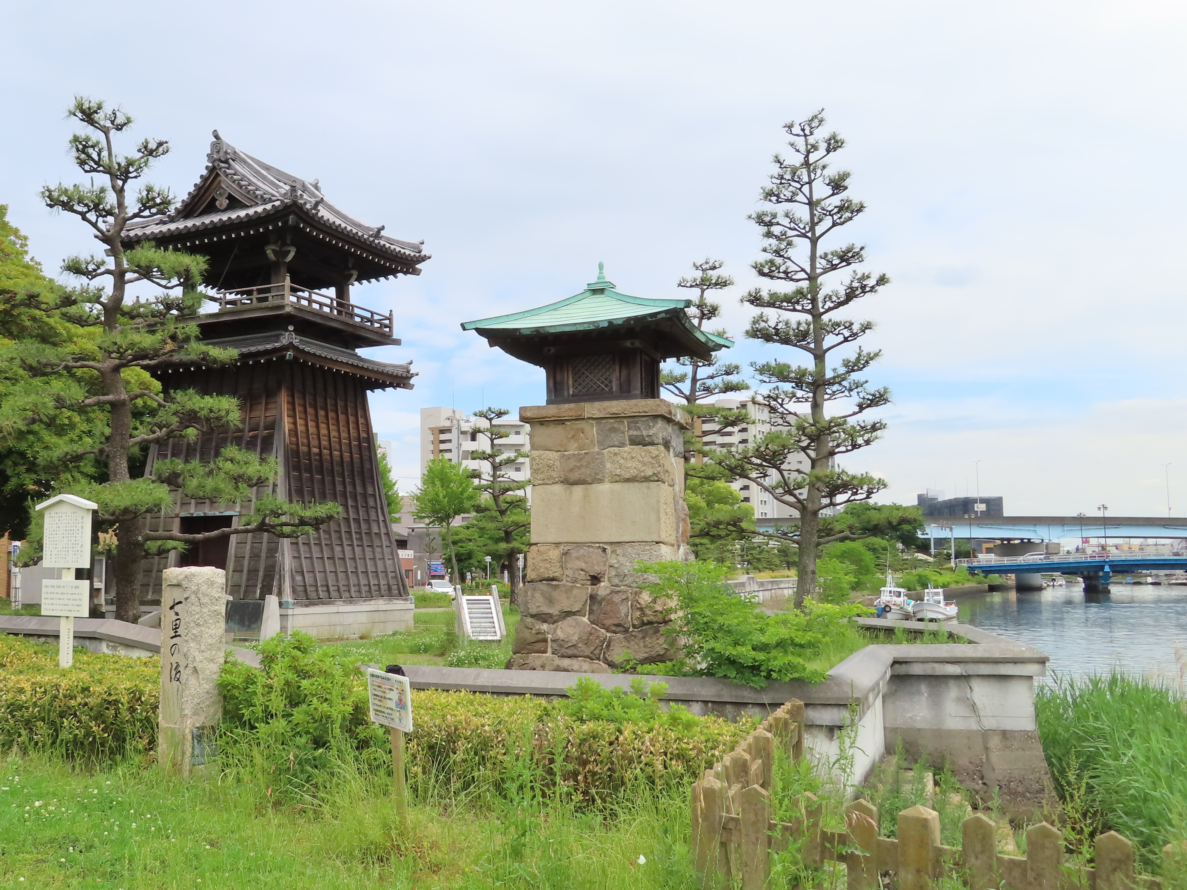
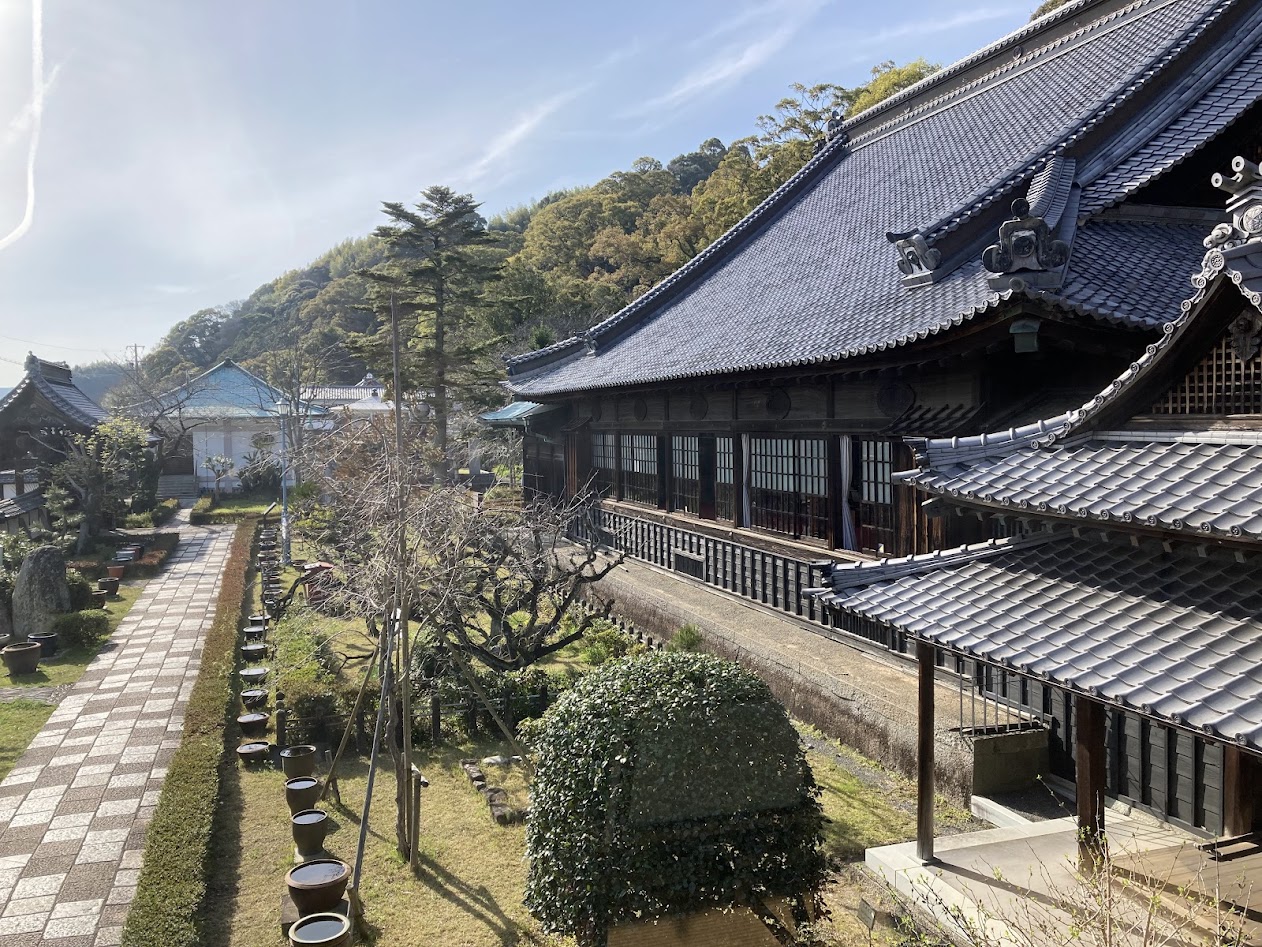
The roads were equipped with facilities that supported travel, including stone paving, pine-lined avenues, milestone mounds, and ferry crossings. These elements show that they were not merely roads, but carefully planned and managed transportation routes.
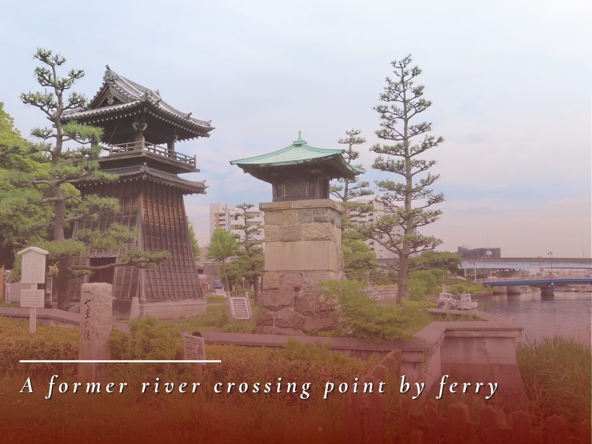
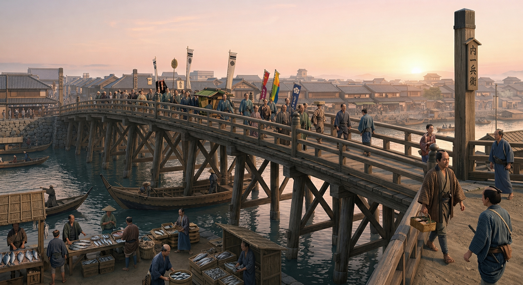
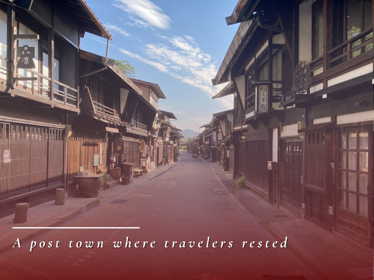
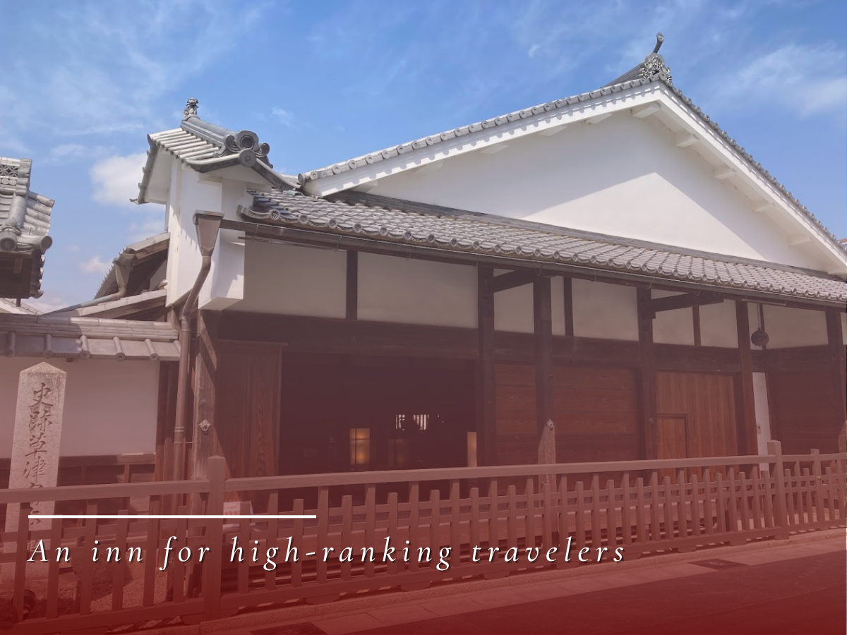
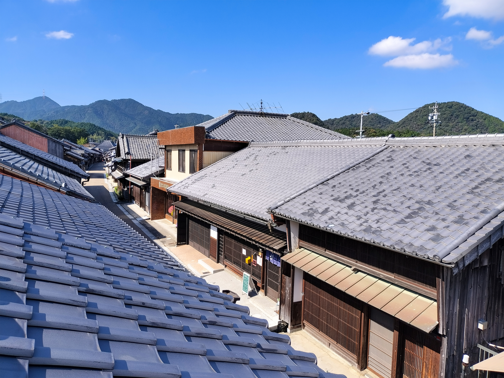
Post towns along the routes also provided honjin, waki-honjin, and hatago inns, welcoming travelers from samurai to commoners. With places for lodging, rest, and resupply arranged at regular intervals, long-distance travel became possible.
In this way, the Tokaido and Nakasendo were transportation spaces where the roads themselves and the facilities along them functioned as one integrated system. Even today, they preserve the overall picture of the highways that supported movement in early modern Japan.
2. National System Supporting Shogunate Rule
The Tokaido and Nakasendo were not only transportation routes for travelers, but also the stage for systems that supported Tokugawa rule. Through sankin-kotai, checkpoint controls, the placement of major castles, and the movement of foreign missions, state authority operated through these roads.
 The Roads Sustained the Shogunate
Traces of governance remain nationwide
→ View Details
The Roads Sustained the Shogunate
Traces of governance remain nationwide
→ View Details
The Tokaido and Nakasendo were not only routes for the movement of people and goods, but also foundations through which the Tokugawa shogunate extended its rule throughout Japan. Political institutions and diplomatic systems functioned through these highways, helping sustain order in early modern Japan.
A leading example was sankin-kotai, the alternate attendance system. Daimyo from across the country were required to travel to Edo at regular intervals, and the Tokaido and Nakasendo served as their principal routes. These grand processions symbolized submission to the shogunate while also stimulating road maintenance and the growth of post towns.
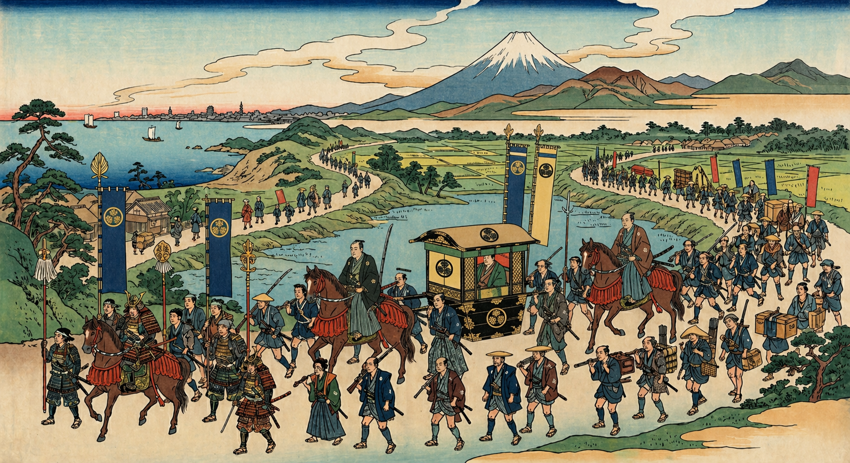
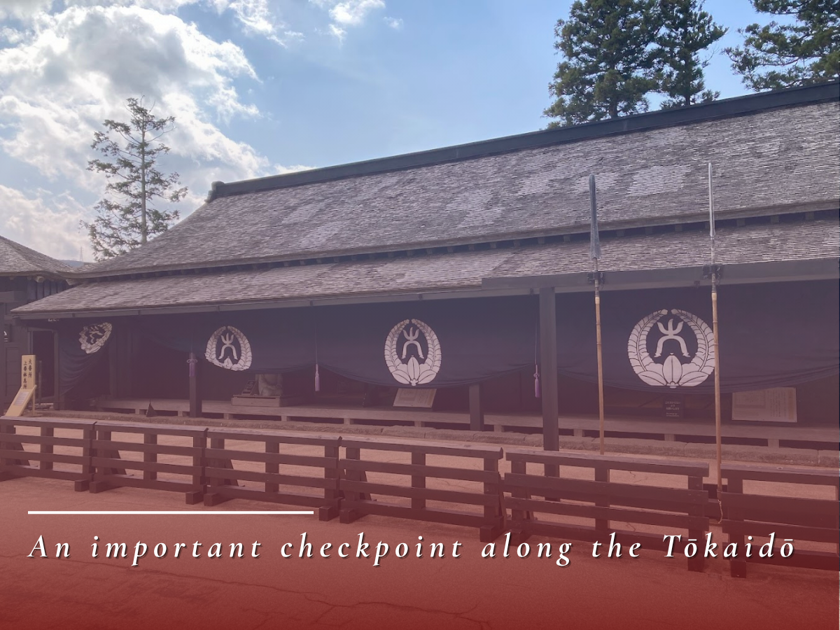
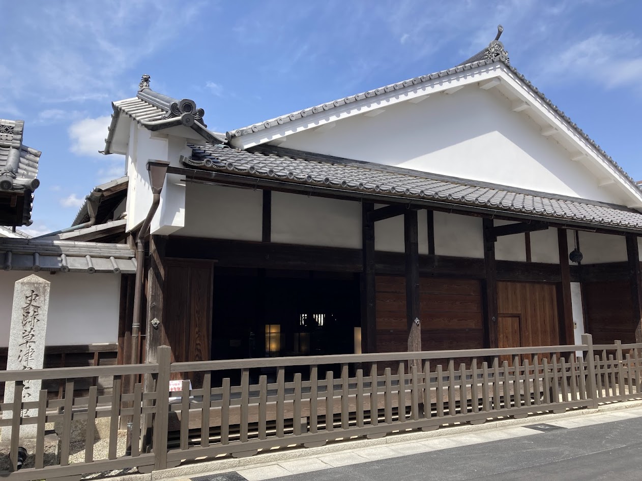
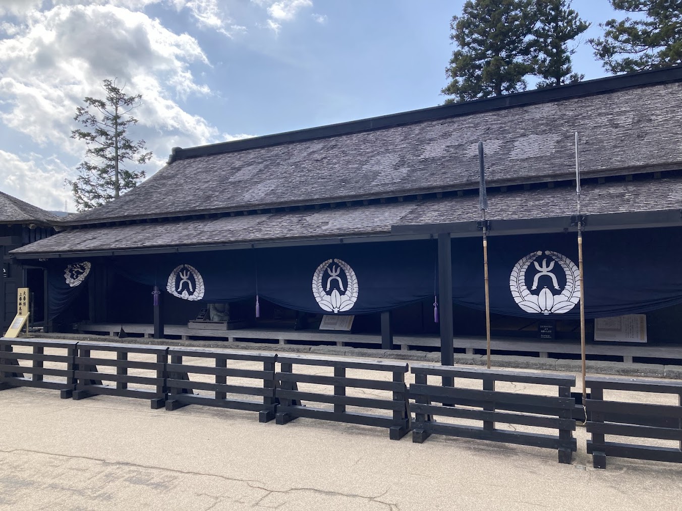
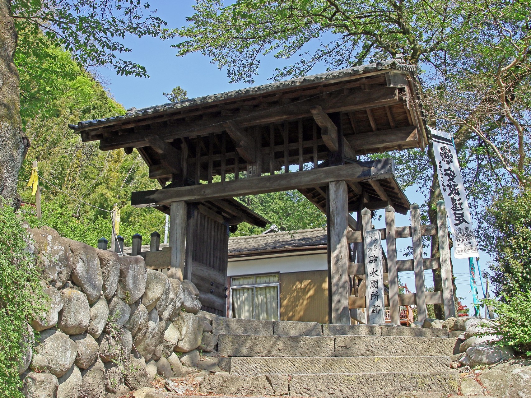
Major checkpoints were also established at strategic locations to control the movement of people and goods. The checkpoints of Hakone, Arai, Usui, and Fukushima were among the most important control points on the Tokaido and Nakasendo, supporting both highway security and the shogunate’s governing system.
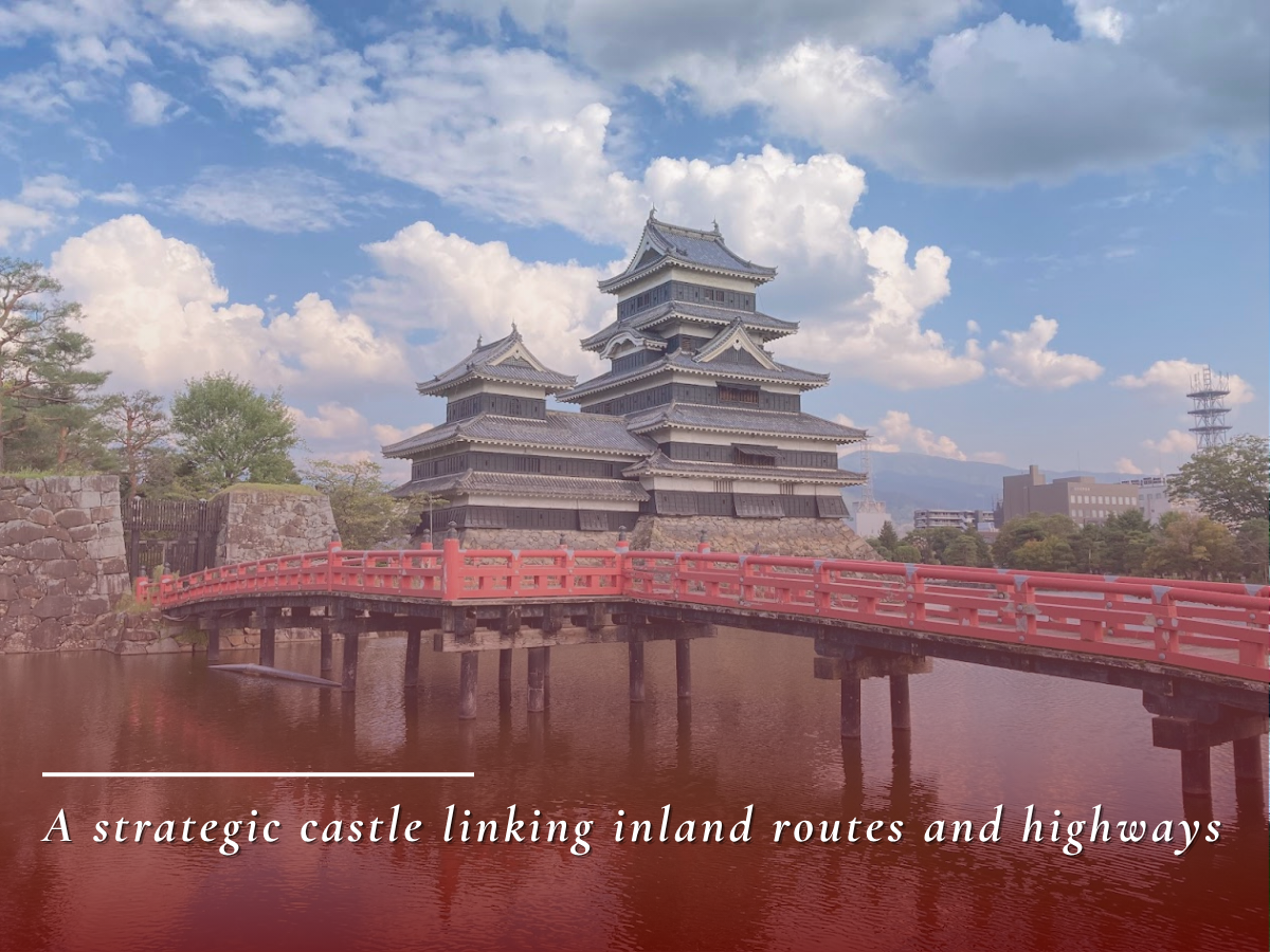
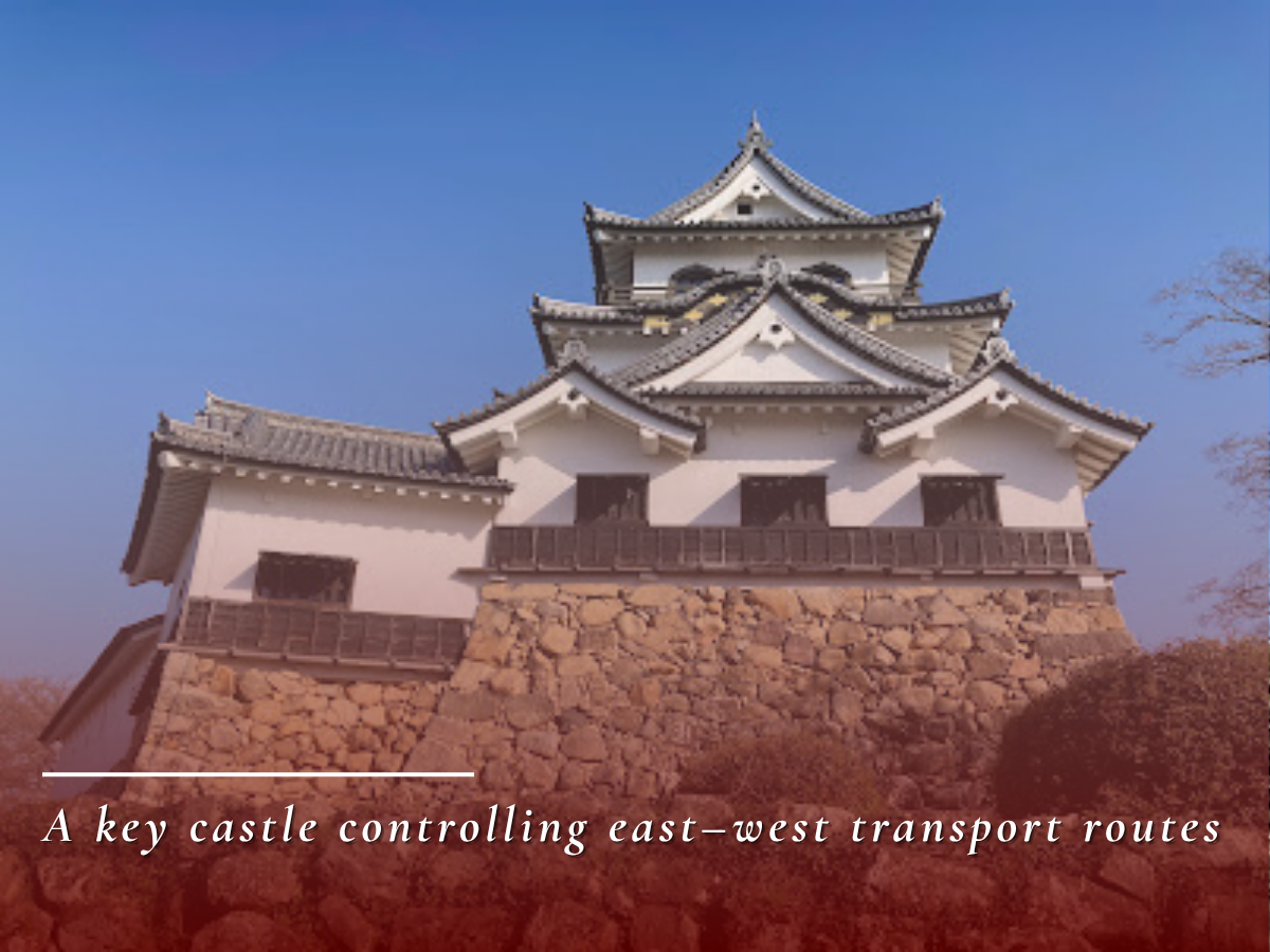
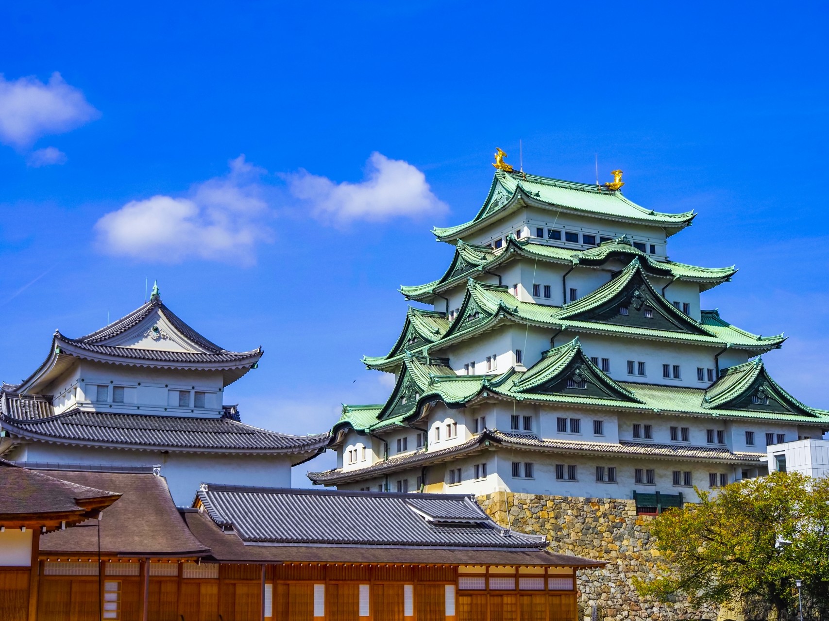
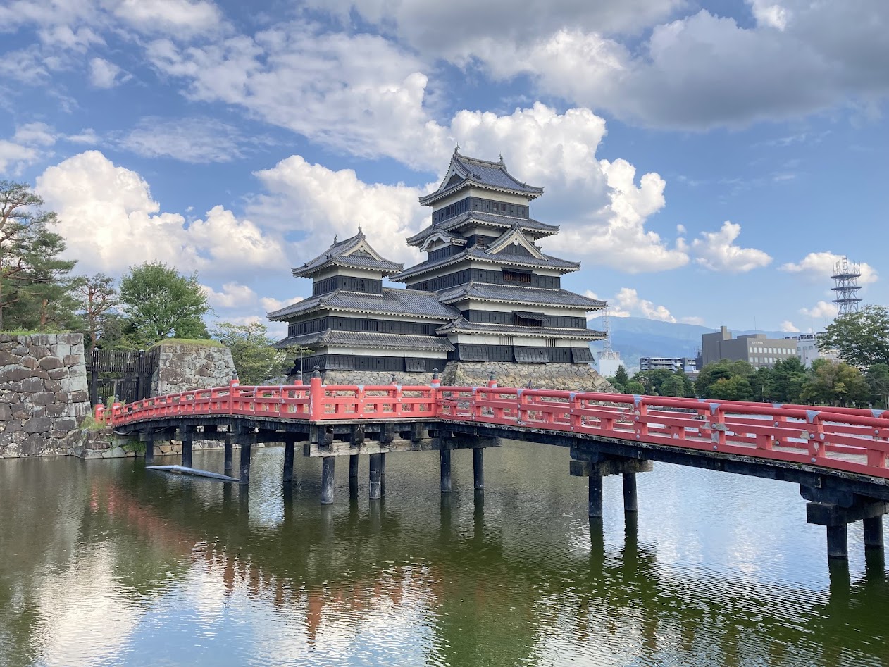
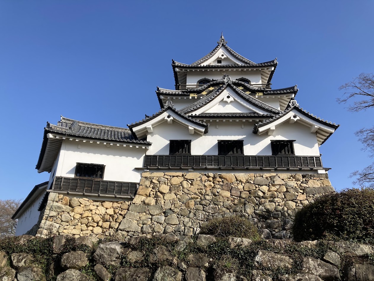
Large castles were positioned along the highways as centers of transportation and defense. These castles served not only as bases of regional rule, but also as key political and military nodes controlling the roads.
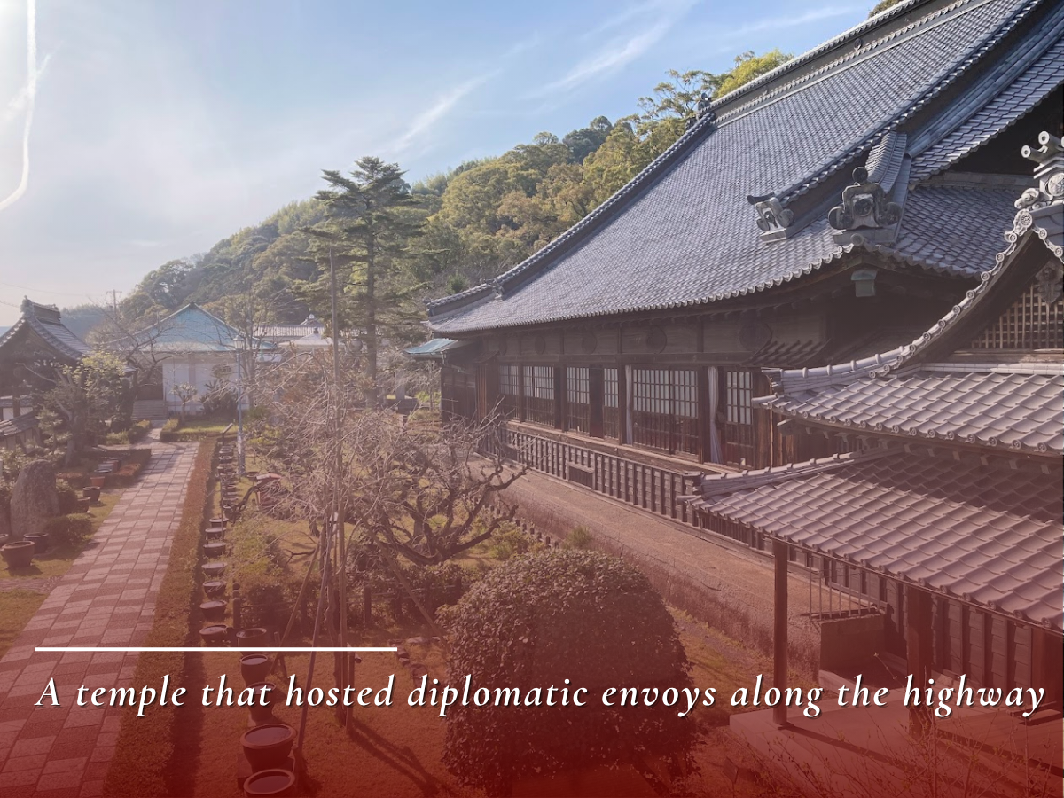
The Tokaido also functioned as a stage for diplomacy as well as domestic governance. Korean envoys and Ryukyuan missions traveled this route to Edo, becoming symbols of international exchange. Some temples along the road were used as lodgings, and Seikenji is known as one such example.
In this way, the Tokaido and Nakasendo formed the stage for national systems that supported Tokugawa rule and foreign relations through sankin-kotai, checkpoints, castles, and diplomatic missions.
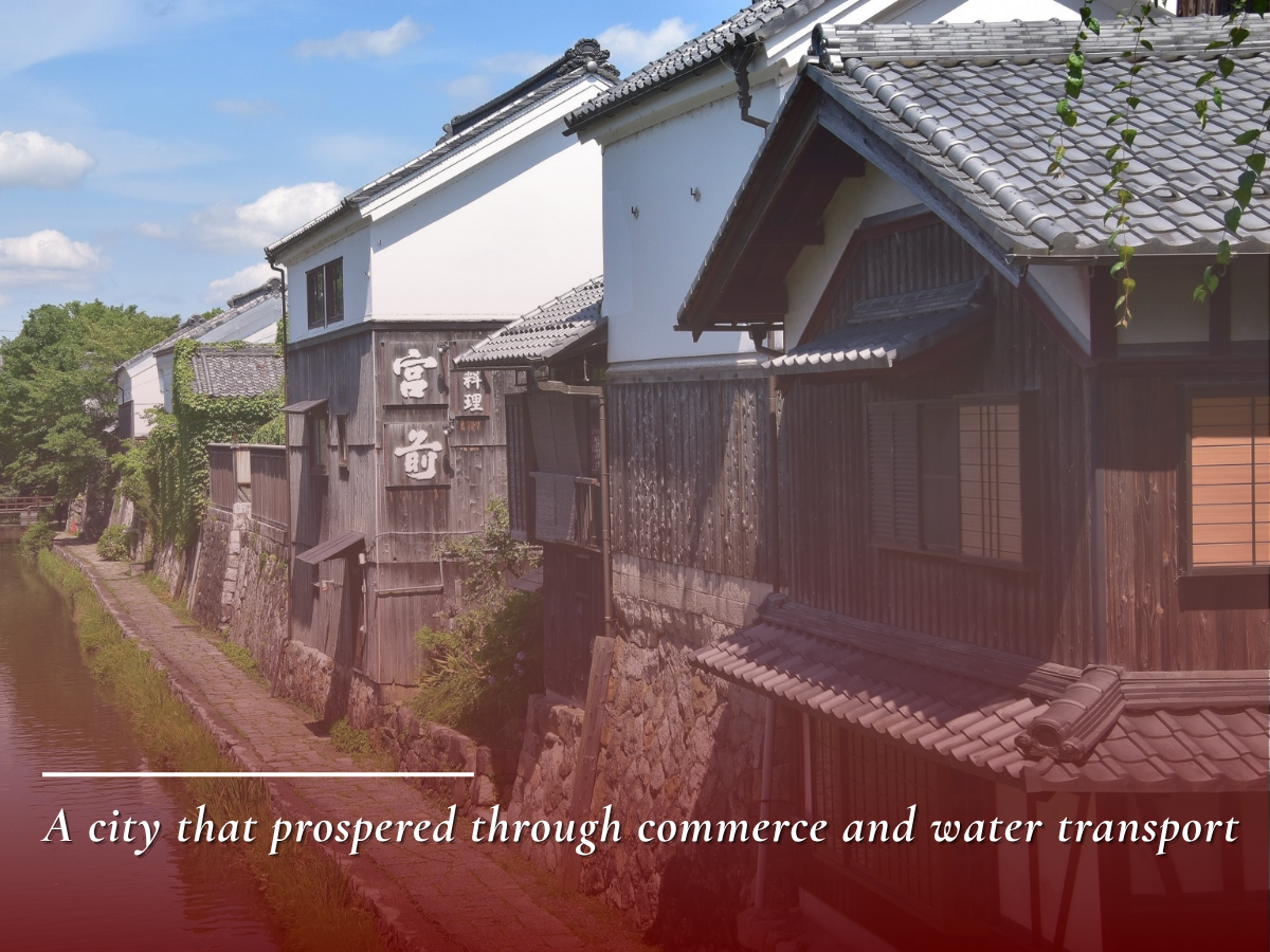
3. Industries and Commerce Along the Routes
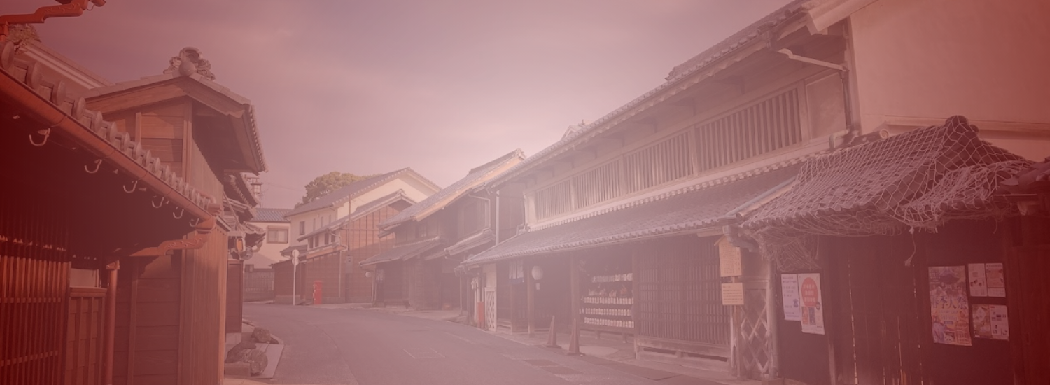
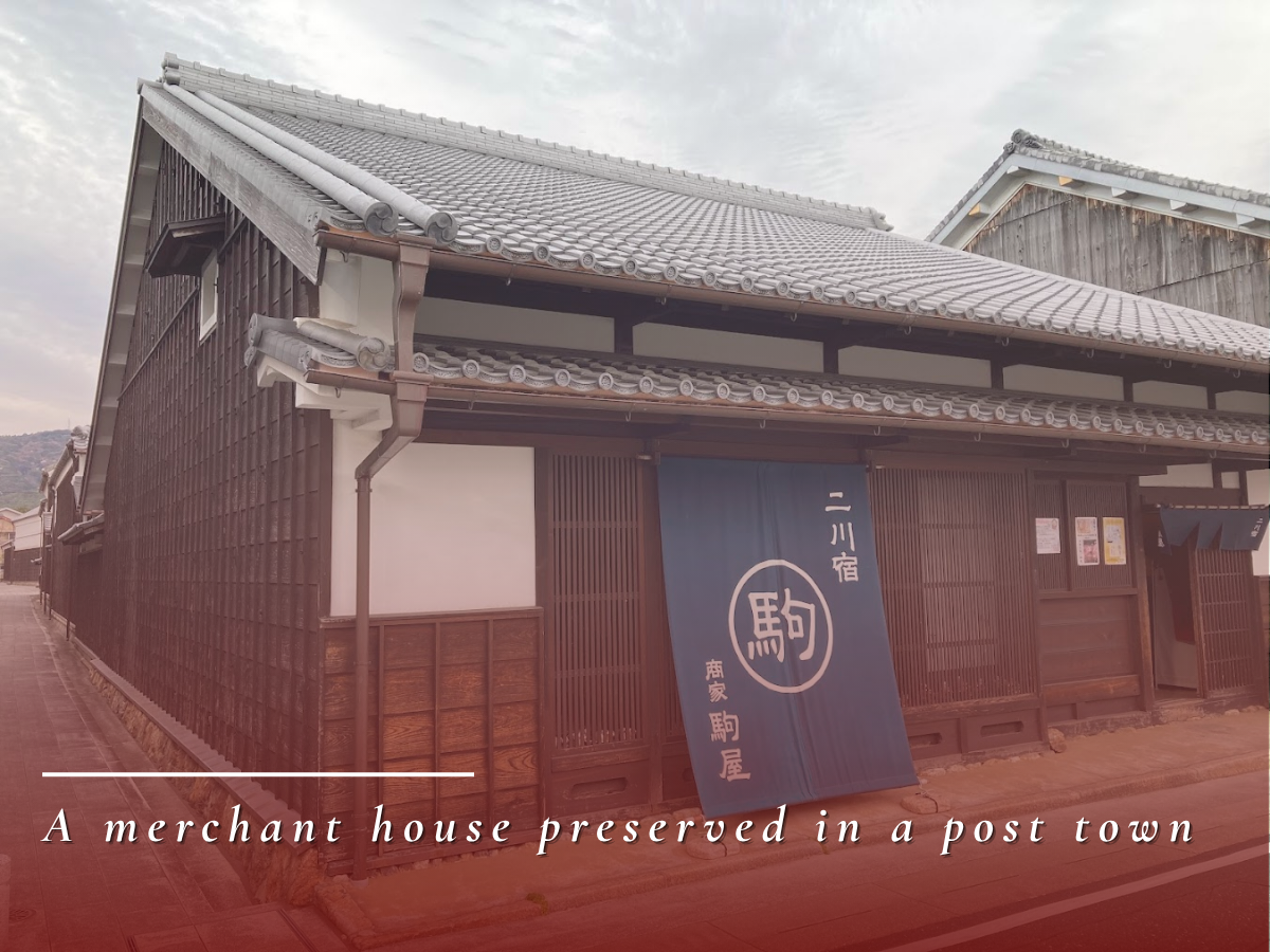
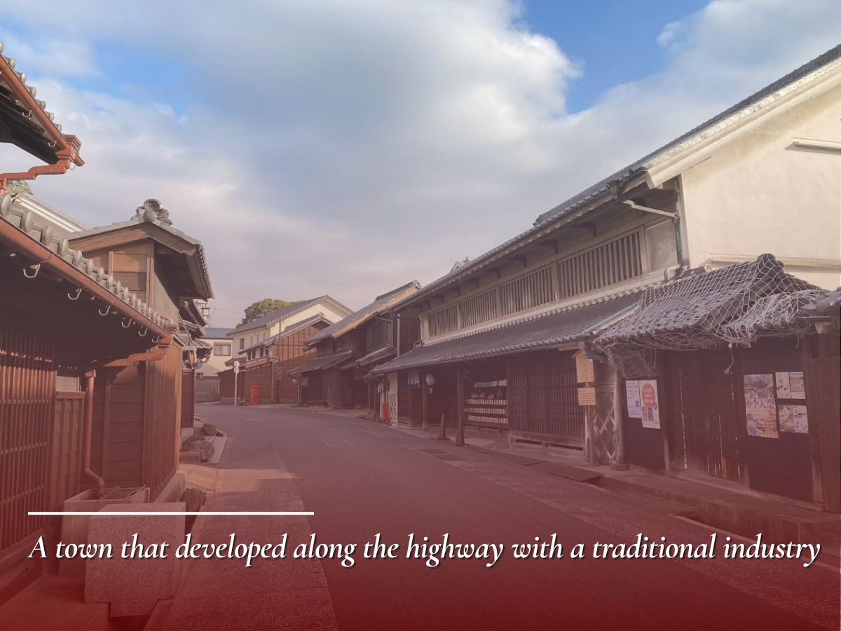
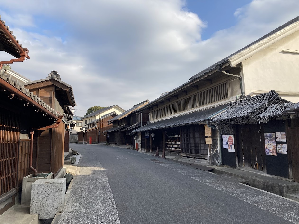
Large numbers of travelers and goods gathered on these roads, and their movement encouraged the growth of commerce and industry in many regions. Merchant houses in post towns, traditional industries, and cities that handled distribution all emerged as part of economic activity linked to the highway network.
 Prosperity Helped Towns Grow
Toward expanding livelihoods
→ View Details
Prosperity Helped Towns Grow
Toward expanding livelihoods
→ View Details
Along the Tokaido and Nakasendo, the constant movement of people and goods created conditions in which commerce and industry could flourish. These highways were not merely travel routes, but also foundations for economic activity.
Merchant houses lined post towns and nearby settlements, supplying travelers and distributing daily necessities. Such commercial activity developed in close connection with traffic along the roads.
Traditional industries that made use of local resources also emerged along the highways. Lacquerware in Kiso-Hirasawa and tie-dyeing in Arimatsu are examples of distinctive regional techniques that developed locally and spread widely through the road network.
Commercial cities such as Omihachiman, where water transport connected with the highways, also grew into important centers for the collection and distribution of goods.
In this way, the highways did more than support travel. By linking commerce, industry, and distribution, they created diverse regional economies along their routes.
4. Culture and Landscapes Shaped by the People
The Tokaido and Nakasendo were not only roads of movement, but also stages that nurtured human sensibility and culture. Celebrated scenery, travel accounts, and historic townscapes connected to these highways are still inherited across Japan today.
 Memories of Travel Became Culture
Journeys through scenery
→ View Details
Memories of Travel Became Culture
Journeys through scenery
→ View Details
The Tokaido and Nakasendo were shared culturally through the landscapes and memories of travel, not only through movement and daily life. Famous places and scenic views along the highways were spoken of and cherished through generations of travelers.
The roads were also depicted in large numbers of ukiyo-e prints, making post towns and landscapes widely known as part of visual culture. In this way, the highways became not only actual travel routes, but also enduring images of the journey itself.
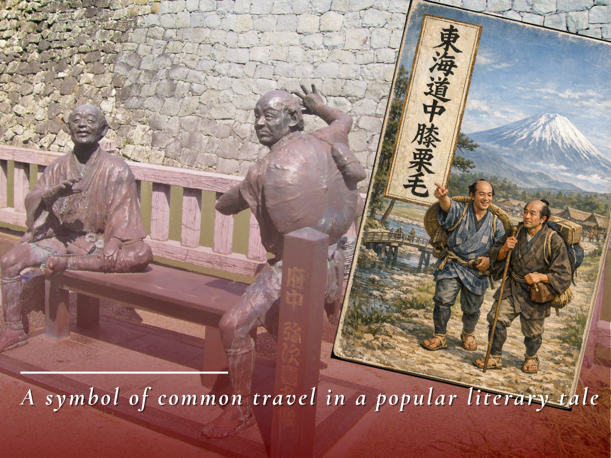
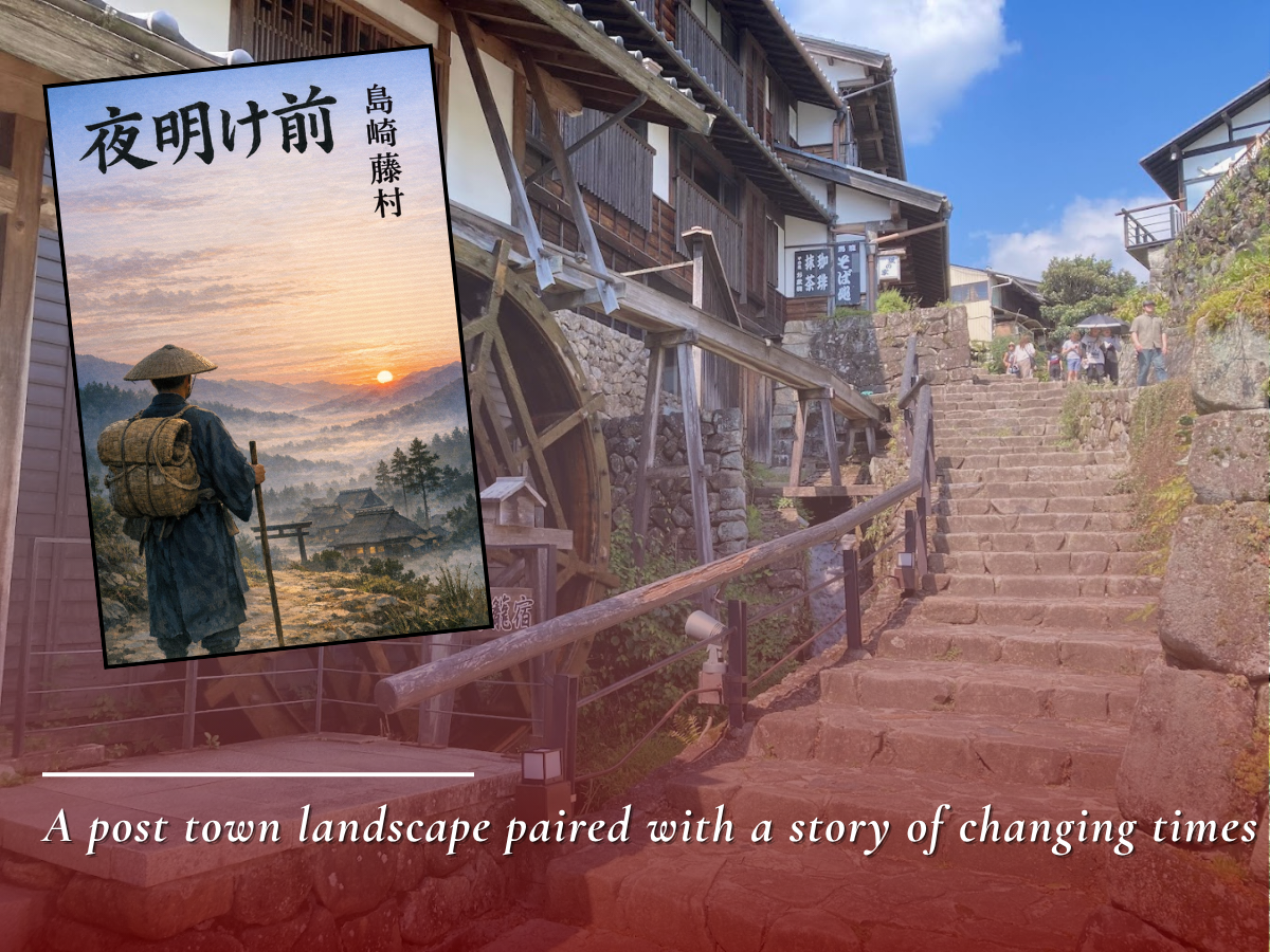
Literary works set on these highways also emerged. In Shank’s Mare on the Tokaido, the journeys of common people were humorously portrayed, while Before the Dawn connected the road with the transformations of a changing age. These works reimagined the highways not simply as transportation routes, but as stages for culture and storytelling.
In this way, the Tokaido and Nakasendo expanded beyond physical travel spaces, becoming shared cultural landscapes expressed through famous places, art, and literature.
Comparison with World Heritage Sites
By comparing the Tokaido and Nakasendo with historic districts and other World Heritage properties, their distinctive value becomes even clearer. Click the imagesthe images to view each comparison.
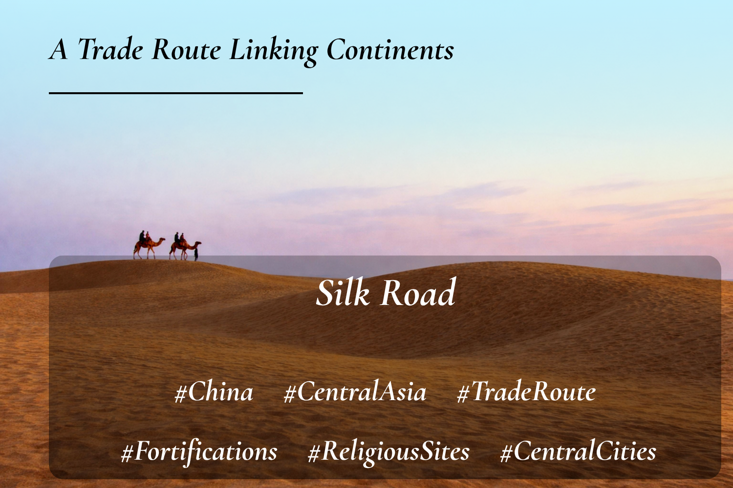
Similarity: Roads that supported exchange and distribution across vast regions
Difference: The Silk Roads were transcontinental trade routes, while the Tokaido and Nakasendo were highways for domestic governance
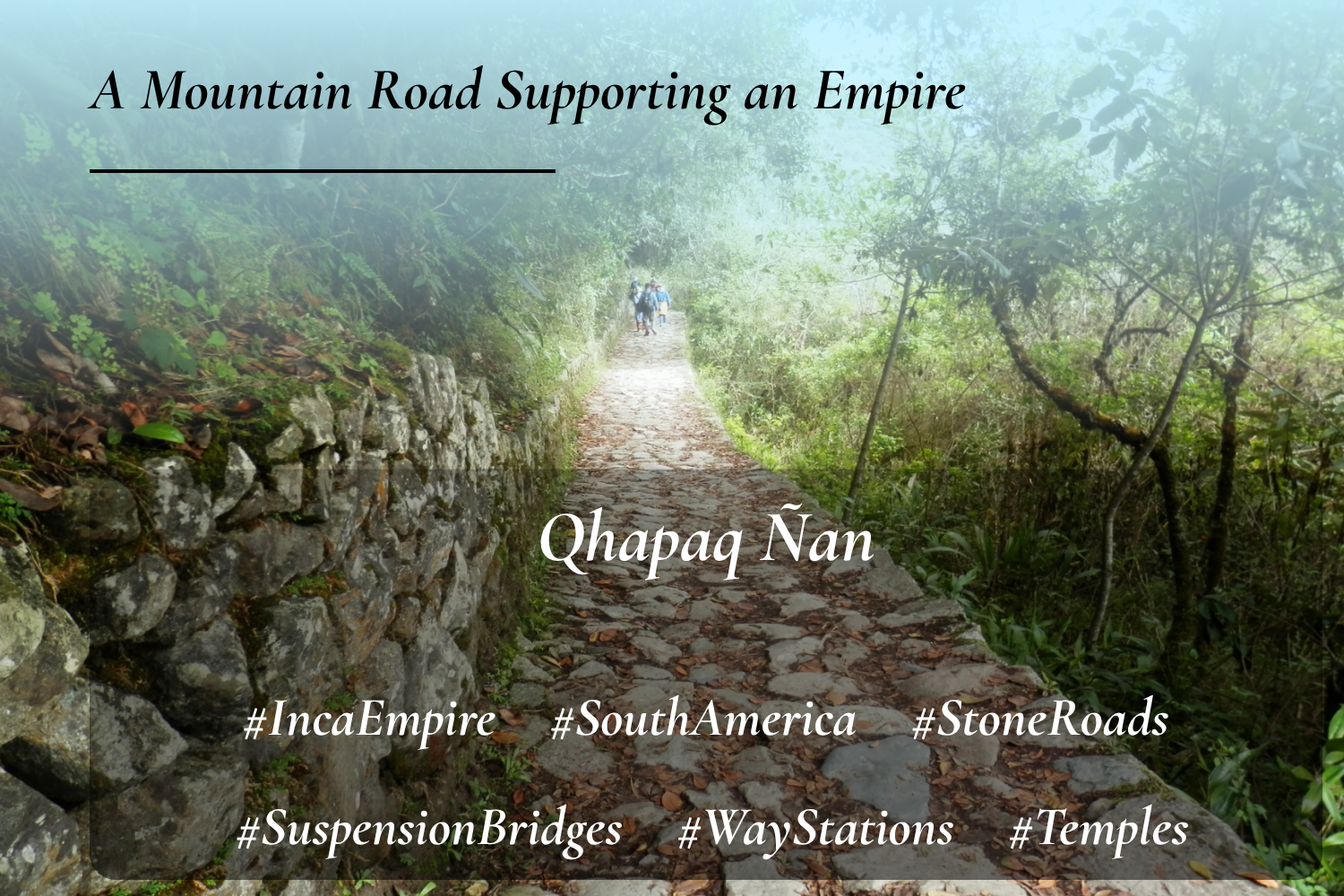
Similarity: Roads that supported state administration and human movement
Difference: Qhapaq Nan was a mountain road network for imperial control, while the Tokaido and Nakasendo were everyday transport routes also used by commoners
Next, a comparison with World Heritage sites in Japan. Click the imagesthe images to explore these comparisons as well.
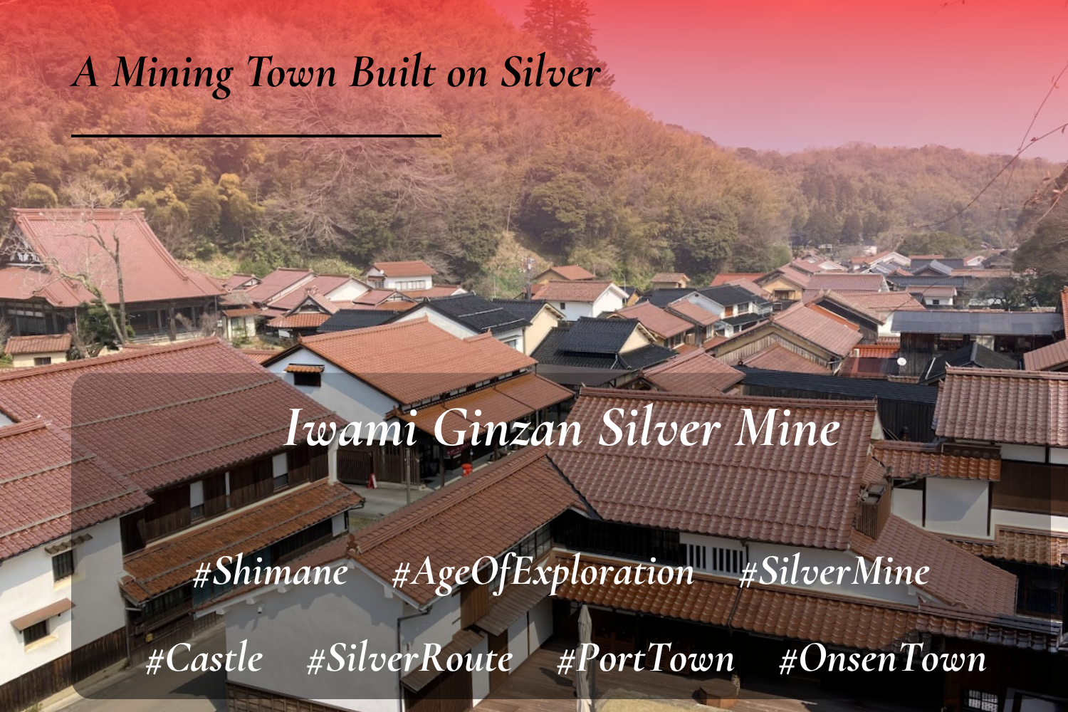
Similarity: Assets that supported economic growth in the Edo period
Difference: Iwami Ginzan is a mining heritage site including roads for transporting silver, while the Tokaido and Nakasendo were highway networks for transporting people
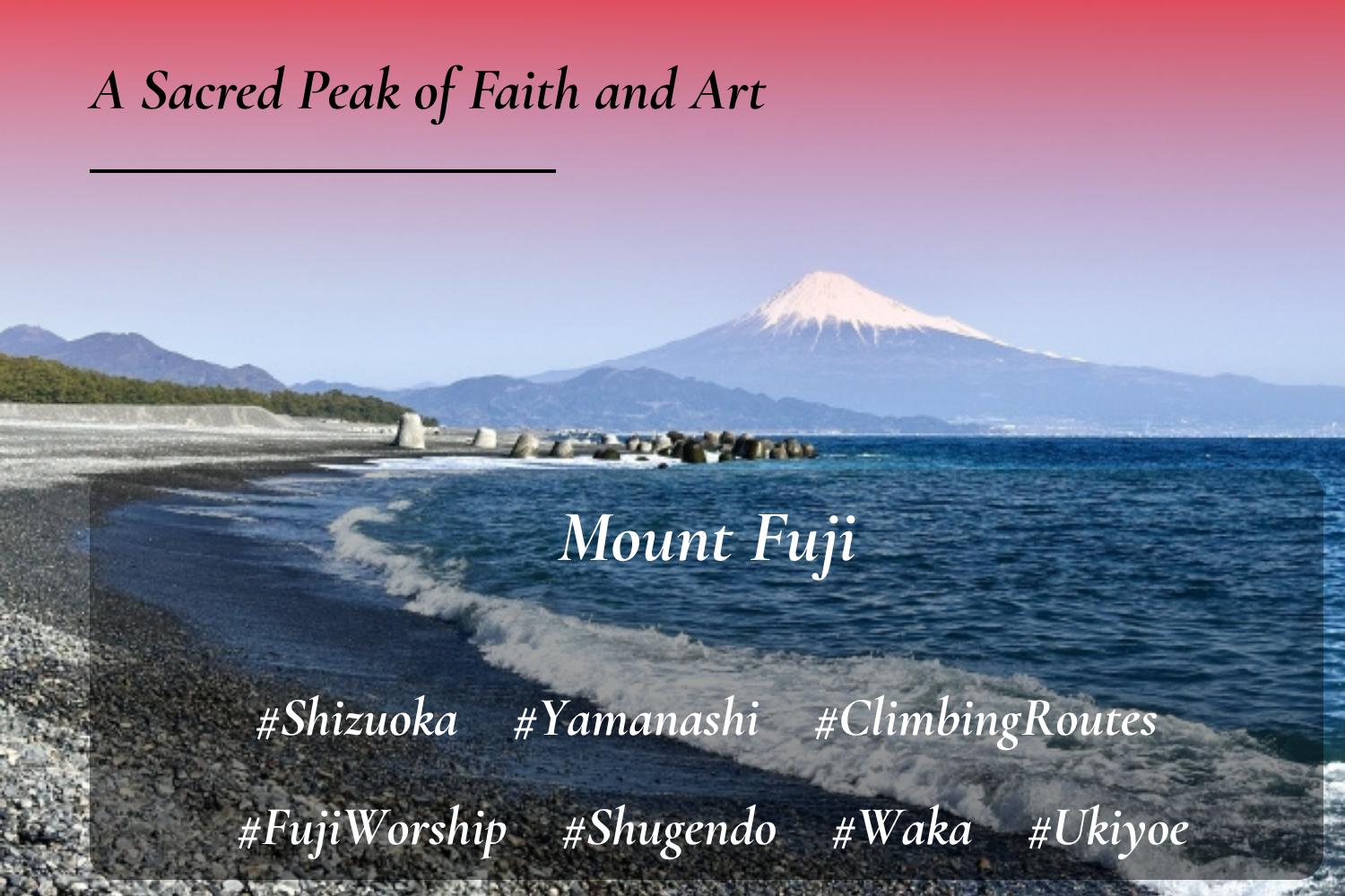
Similarity: Cultural spaces that attracted widespread public interest
Difference: Mount Fuji is a sacred and artistic mountain landscape, while the Tokaido and Nakasendo were highways that moved society itself
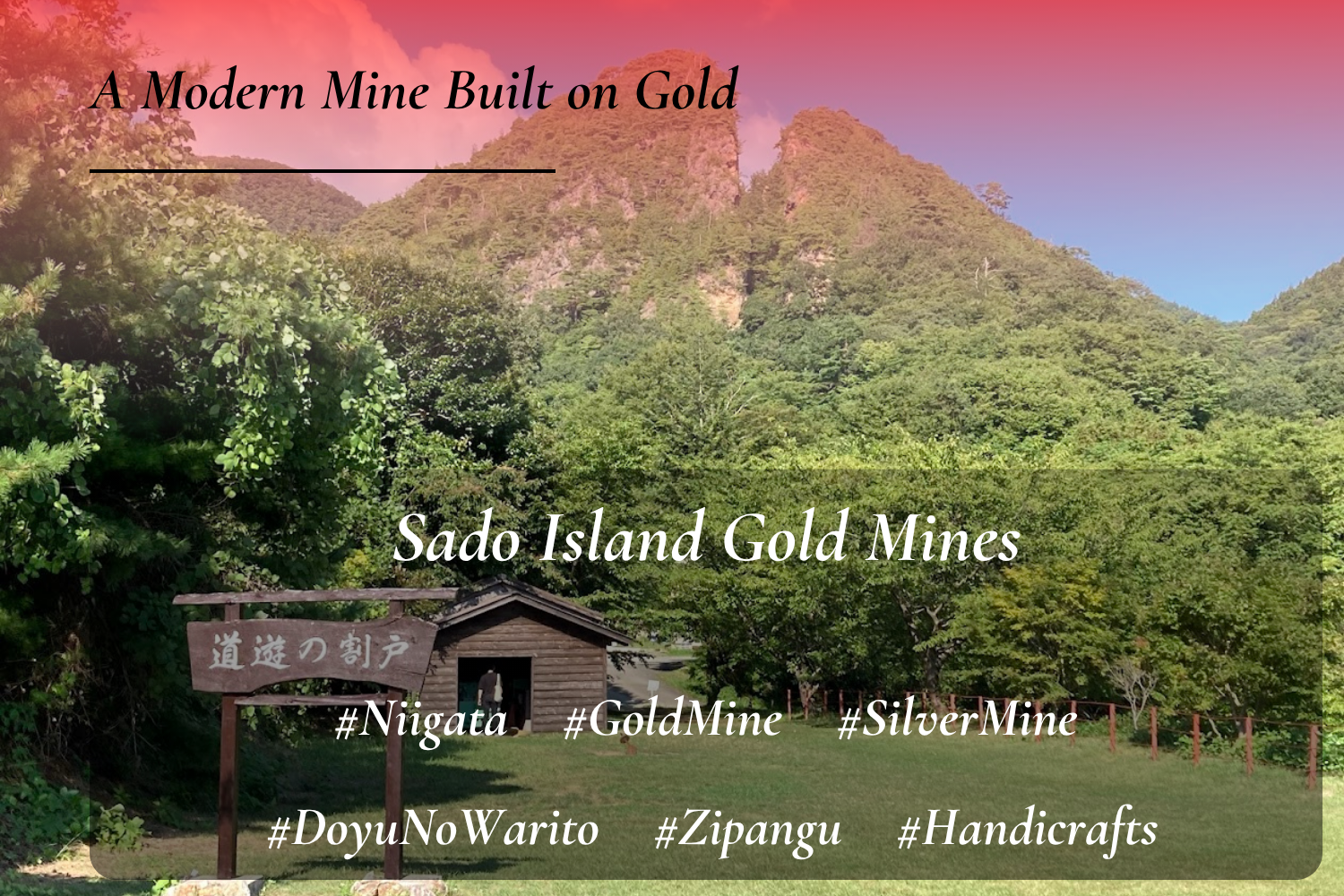
Similarity: Assets that supported the prosperity and finances of the shogunate
Difference: Sado was a production center of gold and silver, while the Tokaido and Nakasendo were transportation axes linking the nation
The Tokaido and Nakasendo combined the functions of transportation, governance, economy, and culture, developing as a continuous highway system under the unified state centered on Edo. As a result, they were more than simple travel routes—they continue to preserve the comprehensive landscape of early modern Japan, where daily life and culture were deeply intertwined.
Why Tokaido and Nakasendo?
At this point, it is worth confirming whether this heritage proposal still demonstrates appropriate value when compared with other cultural properties. In summary, there are three main reasons. Click to viewto view each explanation.
The Tokaido and Nakasendo were developed as the principal highways linking Edo and Kyoto, functioning as the central east-west transportation axis of the Japanese archipelago. While routes such as the Koshu Kaido and Oshu Kaido mainly served regional functions, these two roads were unique in forming the backbone of national integration.
Through sankin-kotai, the checkpoint system, and the movement of foreign missions, the Tokaido and Nakasendo functioned as institutional foundations supporting Tokugawa rule. Their defining feature was that the roads themselves were embedded within the machinery of state governance.
As flows of people, goods, and information concentrated along them, post towns and commercial cities flourished, and a distribution network supporting the economy of Japan was formed around the Tokaido and Nakasendo. These two highways were indispensable economic arteries of early modern Japan.
A highway system combining all of these functions at the same time is without parallel.
Components of the Property
Here we introduce the component parts that make up this proposal.
However, these are only representative examples and should not be regarded as a definitive or exhaustive list.
(Based on available research, approximately 96 related cultural properties have been identified, though the actual number is likely higher.)
Highways and Transportation
Post Towns and Travel
Governance, Defense, and Diplomacy
Commerce and Industry

Criteria
Let us now organize the values discussed so far in relation to the UNESCO World Heritage criteria. This helps clarify the significance of the Tokaido and Nakasendo even further.
Cultural Exchange
An early modern axis of exchange shaped by the movement of people, goods, and culture
As the main highways connecting Edo and Kyoto, the Tokaido and Nakasendo supported the movement of people, goods, and information. Through the network of post towns, diverse regional cultures were interconnected, forming a representative space of cultural exchange in early modern Japan.
Testimony to Civilization
Evidence of the highway system that supported the governance of the Tokugawa shogunate
The Tokaido and Nakasendo were developed as infrastructure for sankin-kotai and official travel, supporting the centralized governance of the Tokugawa shogunate. The integrated system of roads, post towns, and checkpoints preserves the structure of early modern state order and society.
Interaction Between People and Nature
A transportation landscape shaped in harmony with diverse natural environments
The Tokaido and Nakasendo were developed in response to varied natural conditions such as coastlines, rivers, mountain passes, and plains. Bridges, ferry crossings, mountain routes, and post towns reflect a rational land-use system adapted to the natural environment.
Association with Belief and Tradition
A cultural and artistic stage shaped by the memory of travel
The Tokaido and Nakasendo were widely experienced as routes of travel and pilgrimage, becoming subjects of literature, art, and belief. In particular, landscapes depicted in ukiyo-e prints and travel guides symbolize the aesthetic sense and travel culture of early modern Japan.
In Closing
Today, the journey between Tokyo (Edo) and Kyoto can be completed in a short time by Shinkansen or car. Yet within that speed, the towns and landscapes that once lay along the route pass by without being remembered.
In the past, travel meant moving on foot over many days. Even milestones that are now easily overlooked once served as clear markers for travelers, helping them understand distance and take each next step. Along these accumulated paths, post towns, checkpoints, merchant towns, scenic spots, and cultural elements were linked together, living alongside the daily lives of the people who used them.
Along the way, travelers would pause within these landscapes, catching their breath, complaining of fatigue, choosing souvenirs for those waiting for them, and then continuing on toward the next town.
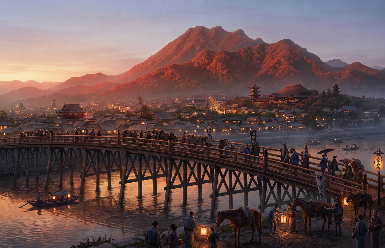
The journey ends at Sanjō Ōhashi, Kyoto
In an age where speed is value, there are landscapes that can only be seen along slower paths. The Tokaido and Nakasendo quietly remind us of that fact.
Great arteries that once drove Edo-period Japan, and roads layered with memories of travel. On the Tokaido and Nakasendo, these two layers of time still quietly live on today.
A “World Heritage Site” like this—why not?